|
Error processing SSI file |
||
|
Error processing SSI file |
||
| Error processing SSI file |
||
|
Error processing SSI file
|
The New Hampshire and Southern Maine Ocean Uses Atlas

The MPA Center's Ocean Uses Team has re-released products from the New Hampshire and Southern Maine Ocean Uses Atlas Project to highlight the utility of ocean use data for response, assessment and restoration. 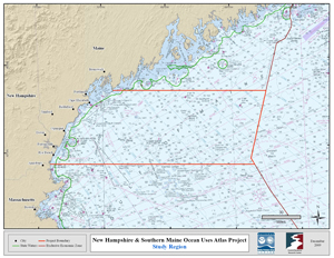
The New Hampshire and Southern Maine Ocean Uses Atlas Project is an innovative partnership between NOAA's Marine Protected Areas Center and the University of New Hampshire’s Coastal Response Resource Center CRCC. Inspired by and used in the March 2010 Spill of National Significance drill (SONS 2010), the Atlas project fills a critical information gap in response efforts and ocean management by mapping, for the first time, the full range of significant human uses of the ocean in state and federal waters off of the coast of New Hampshire and southern Maine. Spatial data for nearly 30 ocean uses were gathered during a participatory mapping workshop convened with regional ocean use experts. The resulting atlas data provides baseline information regarding the location and extent to which the ocean environment is used for non-consumptive, fishing, and industrial and military activities. The results of this project can be accessed below and include individual use maps, sector aggregate use maps, and downloadable GIS data. Click here for more information about the New Hampshire and Southern Maine Ocean Uses Atlas. Additional details on workshop logistics and attendees can be found at the CRCC’s Atlas page. Atlas Products and Tools
GIS Data
The spatial database derived from the New Hampshire and Southern Maine Ocean Uses Atlas contains processed data for all the uses mapped with detailed metadata describing the process steps. A map document (.mxd) with sample layouts, layer files for applying suggested symbologies, and various accessory data layers used throughout the data compilation are also included in the zipped data. Click here to access the zipped data (5.5 MB). 
Maps
Various sorts of maps and analytical products can be derived from the New Hampshire and Southern Maine Atlas GIS data. Below are links to static map products for each use. These maps can be used to inform ocean management decisions and identify hot spots and potential conflict zones for various combinations of ocean uses in California. Map books can be downloaded by clicking the links below: 
Documents
See links below for background documents and related resources for the New Hampshire and Southern Maine Ocean Uses Atlas: For Additional Information Dr. Mimi D'Iorio, GIS Manager, National MPA Center Dr. Nancy Kinner, UNH Co-Director, Coastal Response Research Center Disclaimer |
|
