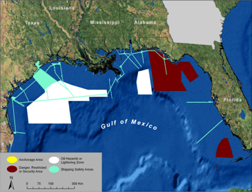
Sometimes, specific areas of the ocean are officially delineated for reasons other than conservation, such as economic use, human health or safety, protection of government or private property, or national security. Called "de facto MPAs" (DFMPAs), these are places where activities are restricted by law for reasons other than conservation or natural resource management. Familiar examples include: safety, security, and danger zones, restricted areas, prohibited lightering areas, some anchorage grounds, and traffic separation schemes. Because DFMPAs can affect access and ocean uses by people, their location, size and purposes are of interest to users, conservationists, scientists and ocean planners.
The De Facto MPA Database (ESRI .gdb) is a geospatial database designed by the MPA Center to catalog De Facto MPAs in the U.S. Created using the publicly available Code of Federal Regulations (CFR), this database combines spatial boundary data with information about the location, purpose, jurisdiction, level and types of restrictions within all federal DFMPAs.
State of the Nation's DeFacto Marine Protected Area Report (PDF) is a document that summarizes the spatial patterns of DFMPAs in the US through maps, charts, graphs and related analyses. It reports on DFMPA patterns at a regional and nationwide scale as of September 2005.
For More Information
Write to mpainfo@noaa.gov