Ocean Uses

Human uses of the ocean are growing, requiring new and forward-looking approaches to comprehensive ocean planning. To meet this challenge, NOAA's National Marine Protected Areas Center is developing place-based ocean planning tools to help coastal communities better understand the drivers, patterns, conflicts and benefits of ocean uses along their shores.
Ocean Use Tools
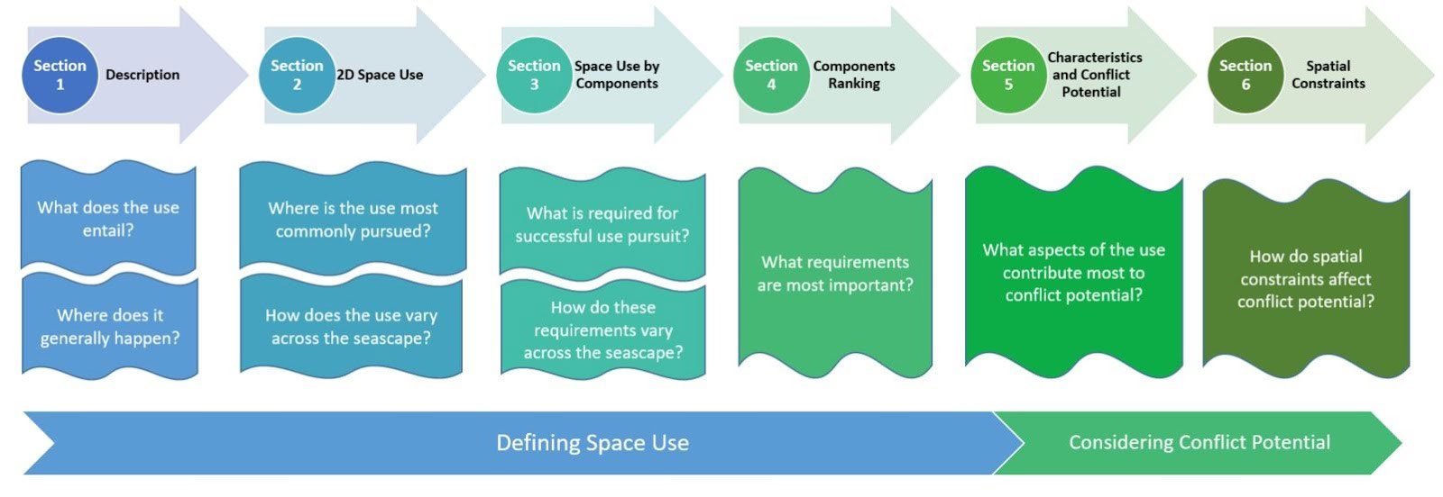
A Guide to Building and Applying Space Use Profiles for Ocean Management (2020): a new framework to help ocean planners, managers, and stakeholders envision the full three-dimensional space requirements of different ocean uses, and to understand how their spatial footprints can create conflicts with other ocean uses in the same area.
A Common Language of Ocean Uses: Flexible definitions of a wide range of typical ocean uses to help planners, managers and stakeholders map and understand the drivers, impacts and benefits of ocean uses across multiple scales.
Guidebook to Participatory Mapping of Ocean Uses: A guide to participatory mapping process to gather ocean use data by engaging local and regional ocean experts through interactive mapping (published with NOAA’s Office for Coastal Management). You can also visit How to Map Ocean Uses with Participatory GIS for an abbreviated version of the guidebook.
Ocean Use Data: Click here for spatial data and related products from ocean use mapping projects conducted from 2008-2015.