The Chincoteague Wreck Tagging Program
A Resource by the Marine Protected Areas Federal Advisory Committee (These statements do not necessarily reflect the positions of NOAA or the U.S. Government)
This is a collaborative effort between the US Fish and Wildlife Service, Maryland Historical Trust, Virginia Dept. of Historic Resources, U. of West Florida, and Chincoteague Natural History Association. The study covers approximately 15 miles of beachfront on Assateague Island managed by the USFWS as Chincoteague National Wildlife Refuge. Its primary research goal is to record intertidal wrecks, isolated timbers, and related artifacts, then engage beachgoers in tracking tagged timbers to assess effect of longshore currents on distribution of wreck material. Additional goals involve assessment of materials and attachment methods to improve future tagging, as well as coordination with comparable efforts begun several years earlier by both the Virginia Beach Lifesaving Museum and the State of North Carolina. The broader, and perhaps most significant, goal is to enhance visitor awareness of maritime heritage through multiple levels of public outreach and engagement. With over 2 million visitors annually, nearly all of whom traditionally focus on wildlife observation or family beach activity, Assateague appears an excellent location for this sort of effort.
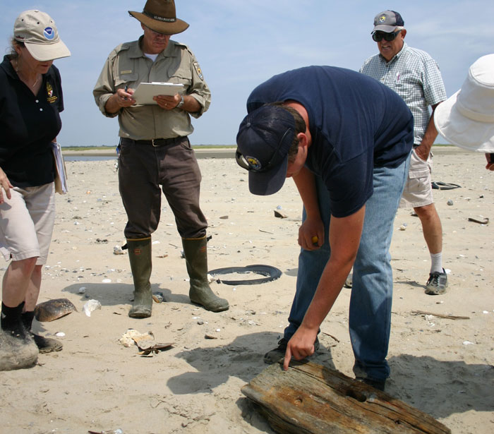
In August of 2013 an initial group of 20 volunteers attended a workshop by staff archaeologists in the partner agencies, concluding with tagging of a small number of timbers. Continuing efforts are directed out by a research intern under direct supervision of the refuge manager and with professional support from the Maryland State Underwater Archaeologist and U. of West Florida faculty.
The program is significantly enhanced by a technological innovation of the student intern: a system of QR coding. Any beachgoer with a smart phone can scan the QR code on a timber, which then sends them to a website that asks a series of simple questions on its discovery location, approximate dimensions, etc. The QR connection also allows discoverers to send a snapshot of "their" timber directly to the website. Researchers then compare that information with the original record to see if the timber's condition has changed and how far and in what direction it has moved. In analogy to finding a message in a bottle: the discoverer is rewarded with a thank you and explanation of study, a photo of the timber when initially tagged, and a map of its recorded travels.
Although the program is very modest in staffing and funding, relying primarily on volunteer hours from the local community and engagement by the general public, its initial year has been quite successful. Nearly 50 timbers have been examined, measured, and photographed; most of them discovered after the initial workshop. There have so far been 31 reported sightings of 17 timbers, a few of which were found to have already traveled considerable distance. A number of wreck-related artifacts varying from intact early 20th c. bottles to pieces of late 19th c. footwear have also been discovered by volunteers and are being catalogued and conserved for study and potential display. Without this program most of that would have been lost. Most volunteers are residents, many with deep maritime roots, who remain very enthusiastic. Impact on the beachgoers is more difficult to measure, but considering that nearly all come for swimming, sunbathing, and wildlife observation it is encouraging that quite a few have taken phone in hand to report discovery of a tagged timber and learn something from its history.